
Vertel uw vrienden over dit artikel:
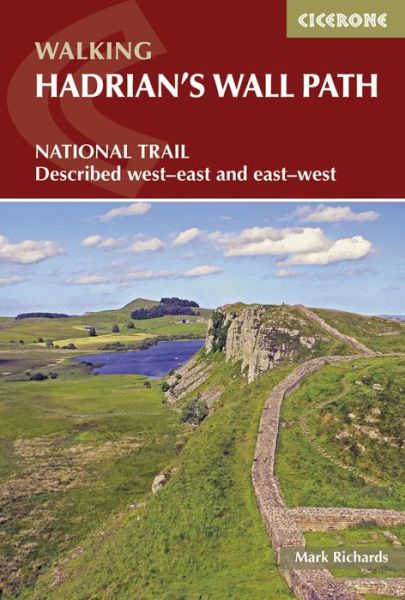
Hadrian's Wall Path: National Trail: Described west-east and east-west 3 Revised edition
Mark Richards
Onze klanten zeggen:

Voeg toe aan uw iMusic-verlanglijst
Ook verkrijgbaar als:
Hadrian's Wall Path: National Trail: Described west-east and east-west 3 Revised edition
Mark Richards
Hadrians Wall Path guidebook to walk the 84 mile National Trail. Described in both directions, the main description is west to east between Bowness-on-Solway and Wallsend, Newcastle, with extensions to Maryport and South Shields. With extensive historical information related to this World Heritage site and separate 1:25,000 OS map booklet included.
240 pages, 107 photographs 16 route maps 2 public transport maps
| Media | Boeken Paperback Book (Boek met zachte kaft en gelijmde rug) |
| Vrijgegeven | 2 november 2015 |
| Datum oorspronkelijke uitgave | 2022 |
| ISBN13 | 9781852845575 |
| Uitgevers | Cicerone Press |
| Pagina's | 240 |
| Afmetingen | 116 × 172 × 18 mm · 340 g |
| Taal en grammatica | Engels |
Alles tonen
Meer door Mark Richards
![Cover for Mark Richards · Walking the Lake District Fells - Keswick: Skiddaw, Blencathra and the North (Paperback Book) [2 Revised edition] (2024)](https://imusic.b-cdn.net/images/item/original/378/9781786310378.jpg?mark-richards-2024-walking-the-lake-district-fells-keswick-skiddaw-blencathra-and-the-north-paperback-book&class=scaled&v=1603165268)
![Cover for Mark Richards · Walking the Lake District Fells - Wasdale: The Scafells, Great Gable, Pillar (Paperback Book) [2 Revised edition] (2024)](https://imusic.b-cdn.net/images/item/original/316/9781786310316.jpg?mark-richards-2024-walking-the-lake-district-fells-wasdale-the-scafells-great-gable-pillar-paperback-book&class=scaled&v=1570392025)
![Cover for Mark Richards · Walking the Lake District Fells - Langdale: The Langdale Pikes and Bowfell (Paperback Book) [2 Revised edition] (2023)](https://imusic.b-cdn.net/images/item/original/323/9781786310323.jpg?mark-richards-2023-walking-the-lake-district-fells-langdale-the-langdale-pikes-and-bowfell-paperback-book&class=scaled&v=1570392026)
![Cover for Mark Richards · Hadrian's Wall Path Map Booklet: 1:25,000 OS Route Mapping (Paperback Book) [2 Revised edition] (2023)](https://imusic.b-cdn.net/images/item/original/511/9781786311511.jpg?mark-richards-2023-hadrian-s-wall-path-map-booklet-1-25-000-os-route-mapping-paperback-book&class=scaled&v=1678868909)

![Cover for Mark Richards · Walking the Lake District Fells - Borrowdale: Scafell Pike, Catbells, Great Gable and the Derwentwater fells (Paperback Book) [2 Revised edition] (2021)](https://imusic.b-cdn.net/images/item/original/385/9781786310385.jpg?mark-richards-2021-walking-the-lake-district-fells-borrowdale-scafell-pike-catbells-great-gable-and-the-derwentwater-fells-paperback-book&class=scaled&v=1604581687)
![Cover for Mark Richards · Walking the Lake District Fells - Coniston: The Old Man of Coniston, Swirl How, Wetherlam, Duddon valley and Eskdale (Paperback Book) [2 Revised edition] (2021)](https://imusic.b-cdn.net/images/item/original/392/9781786310392.jpg?mark-richards-2021-walking-the-lake-district-fells-coniston-the-old-man-of-coniston-swirl-how-wetherlam-duddon-valley-and-eskdale-paperback-book&class=scaled&v=1603707952)
![Cover for Mark Richards · Walking the Lake District Fells - Buttermere: High Stile, Grasmoor, Grisedale Pike and Haystacks (Paperback Book) [2 Revised edition] (2020)](https://imusic.b-cdn.net/images/item/original/361/9781786310361.jpg?mark-richards-2020-walking-the-lake-district-fells-buttermere-high-stile-grasmoor-grisedale-pike-and-haystacks-paperback-book&class=scaled&v=1603188511)
![Cover for Mark Richards · Walking the Lake District Fells - Mardale and the Far East: High Street and Kentmere (Paperback Book) [2 Revised edition] (2020)](https://imusic.b-cdn.net/images/item/original/354/9781786310354.jpg?mark-richards-2020-walking-the-lake-district-fells-mardale-and-the-far-east-high-street-and-kentmere-paperback-book&class=scaled&v=1592150215)

![Cover for Mark Richards · Java Message Service 2e (Paperback Book) [2 Revised edition] (2009)](https://imusic.b-cdn.net/images/item/original/049/9780596522049.jpg?mark-richards-2009-java-message-service-2e-paperback-book&class=scaled&v=1542310642)
Anderen hebben ook gekocht


Bekijk alles van Mark Richards ( bijv. Paperback Book , Hardcover Book , Pamphlet , Book en CD )