
Vertel uw vrienden over dit artikel:
Rand McNally Folded Map: New England
Rand McNally
Besteld in een afgelegen magazijn
Onze klanten zeggen:

Rand McNally Folded Map: New England
Rand McNally
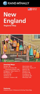
Rand McNally's folded map featuring New England is a must-have for anyone traveling in and around this part of the country, offering unbeatable accuracy and reliability at a great price. Our trusted cartography shows all Interstate, state, and county highways, along with clearly indicated points of interest, airports, county boundaries, and more. You'll see why Rand McNally folded maps have been the trusted standard for years. -Regularly updated, full-color maps. -Clearly labeled Interstate, U. S., state, and county highways. -Detail maps of major cities, a mileage chart, and a Mileages & Driving Times Map. -Indications of parks, points of interest, airports, county boundaries, and more. -Easy-to-use legend. -Detailed index. -Convenient folded size. Coverage Area Detailed maps of: Bridgeport, CT; Hartford, CT; New Haven, CT; Boston & Vicinity, MA; Boston Downtown, MA; Springfield, MA; Worcester, MA; Bangor, ME; Lewiston, ME; Portland, ME; Concord, NH; Manchester, NH; Nashua, NH; Newport, RI; Providence, RI; Burlington VT. Product Details: Measures 9.5 x 4.125 and folds out to 40 x 28.
| Media | Boeken Map (Land- of zeekaarten) |
| Vrijgegeven | 11 oktober 2021 |
| ISBN13 | 9780528025778 |
| Uitgevers | Rand McNally |
| Afmetingen | 100 × 234 × 10 mm · 58 g |
| Taal en grammatica | Engels |
Meer door Rand McNally


Anderen hebben ook gekocht
![Cover for Preben Hansen · Turen Går Til: Turen går til Californien & Vestlige USA (Sewn Spine Book) [5e uitgave] (2021)](https://imusic.b-cdn.net/images/item/original/578/9788740063578.jpg?preben-hansen-2021-turen-gaar-til-turen-gaar-til-californien-vestlige-usa-sewn-spine-book&class=scaled&v=1623395637)
![Cover for Knud Romer · Den som blinker er bange for døden (Sewn Spine Book) [5e uitgave] (2016)](https://imusic.b-cdn.net/images/item/original/573/9788711569573.jpg?knud-romer-2016-den-som-blinker-er-bange-for-doeden-sewn-spine-book&class=scaled&v=1480182943)
![Cover for Kerstin Ekman · Ulvespring (Bound Book) [1e uitgave] (2022)](https://imusic.b-cdn.net/images/item/original/272/9788702347272.jpg?kerstin-ekman-2022-ulvespring-bound-book&class=scaled&v=1661970721)
![Cover for Jens Andersen · Kongeord (Bound Book) [1e uitgave] (2024)](https://imusic.b-cdn.net/images/item/original/776/9788740092776.jpg?jens-andersen-2024-kongeord-bound-book&class=scaled&v=1706260512)


Bekijk alles van Rand McNally ( bijv. Paperback Book , Map , Hardcover Book , Book en Spiral Book )