

Vertel uw vrienden over dit artikel:
Maine State Map, Rand McNally
Rand McNally
Besteld in een afgelegen magazijn
Onze klanten zeggen:

Maine State Map, Rand McNally
Rand McNally
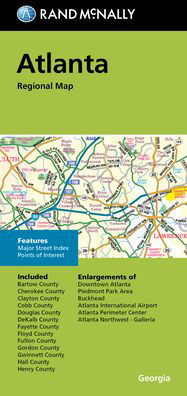
Rand McNally's Easy To Read State Folded Map is a must-have for anyone traveling in and around Maine, offering unbeatable accuracy and reliability at a great price. Our trusted cartography shows all Interstate, U. S., state, and county highways, along with clearly indicated parks, points of interest, airports, county boundaries, and streets. The easy-to-use legend and detailed index make for quick and easy location of destinations. Regularly updated, full-color maps. Clearly labeled Interstate, U. S., state, and county highways. Indications of parks, points of interest, airports, county boundaries, and more. Mileage and driving times map. Detailed index. Convenient folded size. Coverage Area: Detailed maps of Acadia National Park, Augusta, Bangor, Brunswick/Bath, Kittery/Portsmouth, NH; Lewiston/Auburn, Portland, Saco/Biddeford.
| Media | Boeken Sewn Spine Book (Boek met zachte kaft en genaaide rug van hoge kwaliteit) |
| Vrijgegeven | 15 oktober 2021 |
| ISBN13 | 9780528025822 |
| Uitgevers | Rand McNally |
| Genre | Maps & Guides |
| Afmetingen | 272 g |
| Taal en grammatica | Engels |
Meer door Rand McNally


![Cover for Rand McNally · A Pocket Atlas of the [world] [cartographic Material]: Presented to the Patrons and Friends of the Chicago & North-Western Ry. Co. With the Compliments of the Passenger Department (Paperback Book) (2021)](https://imusic.b-cdn.net/images/item/original/417/9781015179417.jpg?rand-mcnally-2021-a-pocket-atlas-of-the-world-cartographic-material-presented-to-the-patrons-and-friends-of-the-chicago-north-western-ry-co-with-the-compliments-of-the-passenger-department-paperback-book&class=scaled&v=1649334010)
Anderen hebben ook gekocht
![Cover for Preben Hansen · Turen Går Til: Turen går til Californien & Vestlige USA (Sewn Spine Book) [5e uitgave] (2021)](https://imusic.b-cdn.net/images/item/original/578/9788740063578.jpg?preben-hansen-2021-turen-gaar-til-turen-gaar-til-californien-vestlige-usa-sewn-spine-book&class=scaled&v=1623395637)
![Cover for J. K. Rowling · Harry Potter: Harry Potter 6 - Harry Potter og Halvblodsprinsen (Bound Book) [5e uitgave] (2015)](https://imusic.b-cdn.net/images/item/original/277/9788702173277.jpg?j-k-rowling-2015-harry-potter-harry-potter-6-harry-potter-og-halvblodsprinsen-bound-book&class=scaled&v=1441302687)
![Cover for Olga Ravn · De ansatte (Sewn Spine Book) [1e uitgave] (2018)](https://imusic.b-cdn.net/images/item/original/583/9788702265583.jpg?olga-ravn-2018-de-ansatte-sewn-spine-book&class=scaled&v=1521711504)
![Cover for Paludans Bilatlas over Europa 2016 (Spiral Book) [1e uitgave] (2016)](https://imusic.b-cdn.net/images/item/original/473/9788772307473.jpg?2016-paludans-bilatlas-over-europa-2016-spiral-book&class=scaled&v=1532297840)
![Cover for Betty Edwards · Drawing on the Right Side of the Brain: A Course in Enhancing Creativity and Artistic Confidence: definitive 4th edition (Hardcover Book) [Main edition] (2013)](https://imusic.b-cdn.net/images/item/original/778/9780285641778.jpg?betty-edwards-2013-drawing-on-the-right-side-of-the-brain-a-course-in-enhancing-creativity-and-artistic-confidence-definitive-4th-edition-hardcover-book&class=scaled&v=1398870041)

![Cover for Kent Haruf · Eventide - Plainsong (Paperback Book) [Main Market Ed. edition] (2013)](https://imusic.b-cdn.net/images/item/original/457/9781447240457.jpg?kent-haruf-2013-eventide-plainsong-paperback-book&class=scaled&v=1396360108)


![Cover for Barbara Kingsolver · Demon Copperhead: Winner of the Women's Prize for Fiction (Paperback Book) [Main - Re-issue edition] (2023)](https://imusic.b-cdn.net/images/item/original/483/9780571376483.jpg?barbara-kingsolver-2023-demon-copperhead-winner-of-the-women-s-prize-for-fiction-paperback-book&class=scaled&v=1680172538)
![Cover for Disney · Carl Barks & Don Rosa Bind II (Hardcover Book) [1e uitgave] (2020)](https://imusic.b-cdn.net/images/item/original/218/9788793840218.jpg?disney-2020-carl-barks-don-rosa-bind-ii-hardcover-book&class=scaled&v=1596799987)
Bekijk alles van Rand McNally ( bijv. Paperback Book , Map , Hardcover Book , Book en Spiral Book )